Day 71-74: One bivouac to rule them all

When talking about their summers, people in Scandinavia often refer to something magic they call “the week”. It’s the one week in the entire year which brings stable, sunny weather and high temperatures, which might reach the upper twenties. It’s the one and only week during which you can have breakfast and dinner in t-shirt on the trail day after day. A good summer may even offer two or three of those weeks, a bad one can pass without. The summer of 2012 keeps the pleasant surprise for the very end. But in mid-august, when I am about the reach the arctic circle, the weather forecast promises a dazzling series of warm, sunny days. The playground will be the Okstindan and Saltfjellet ranges.

About half an hour after leaving the camping in Hattfjelldal, I realize I have forgotten my Gore-Tex socks, which were drying in the camping building. As they were full of holes anyway and Fre, who will arrive in 5 days, will bring me a new pair, I decide not to turn back and cover the distance on my Sealskinz socks which I use as camp socks. I have another small concern: when going through the maps I have sent to Snasa, I notice I have somehow forgotten to print the maps I wanted to use to packraft across the Rossvatnet lake (later I will find them back in the post package I sent to Kautokeino). I will have to make it with a 1:200000 tourist map I have found in the village.

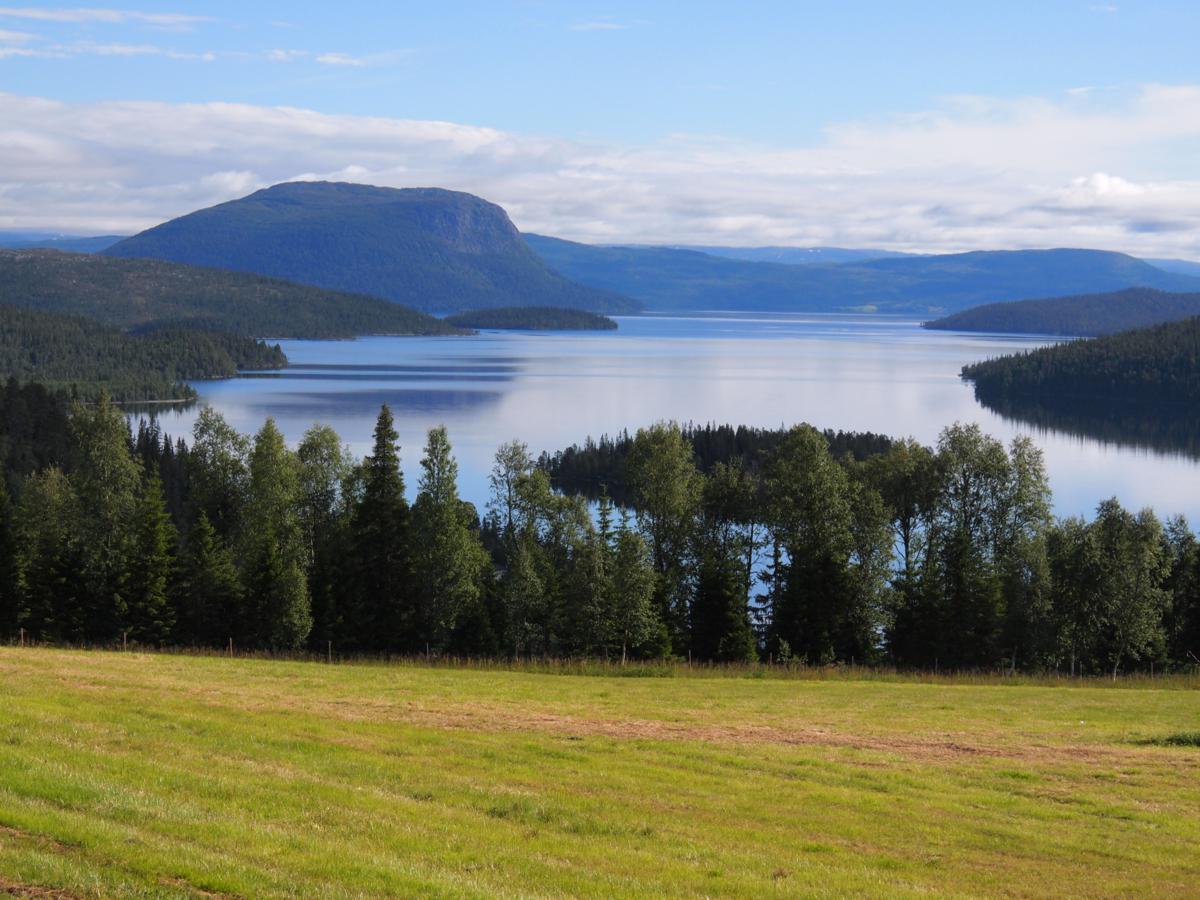
Not too much wind is predicted for the next two days, on which I want to do a 42km flatwater crossing of Rossvatnet, Norway’s second largest lake. My initial plan was to raft the western side of the lake, but as wind will be from the east I divert to the eastern side to have minimal waves.It’s an 11km stroll along the road until I reach the Elvneset inlet at the southern tip of the lake and start inflating my raft. The weather is cool and overcast with regular drizzle, and a very low cloudbase at about 800m. The remainder of the day passes without too much history. With almost no wind I keep paddling well into the evening hours. I beach my raft near the Tolkmoen farm and pitch my Cricket on a meadow.

A break along the Rossvatnet, with the slopes of the Okstindan range in the back

A break along the Rossvatnet, with the slopes of the Okstindan range in the back

The following morning the weather remains unchanged. It’s a pity as the lake could probably offer magnificent views onto the jagged peaks and large glaciers of the Okstindan range, but I rather have low clouds here than while being in the mountains. I pass the Hjartfjellneset narrow and continue following the southeastern shore of the northern part of the enormous lake. After another 20km of flatwater I finally reach the northeastern tip of the Rossvatnet near the Granheim farm. Right at the moment I leave my raft, the clouds start to break and the Okstinden range starts to appear. These first views immediately make the hair on my arms raise. It just feels like something very special is about the happen.

Continuing along the Rossvatnet

Continuing along the Rossvatnet

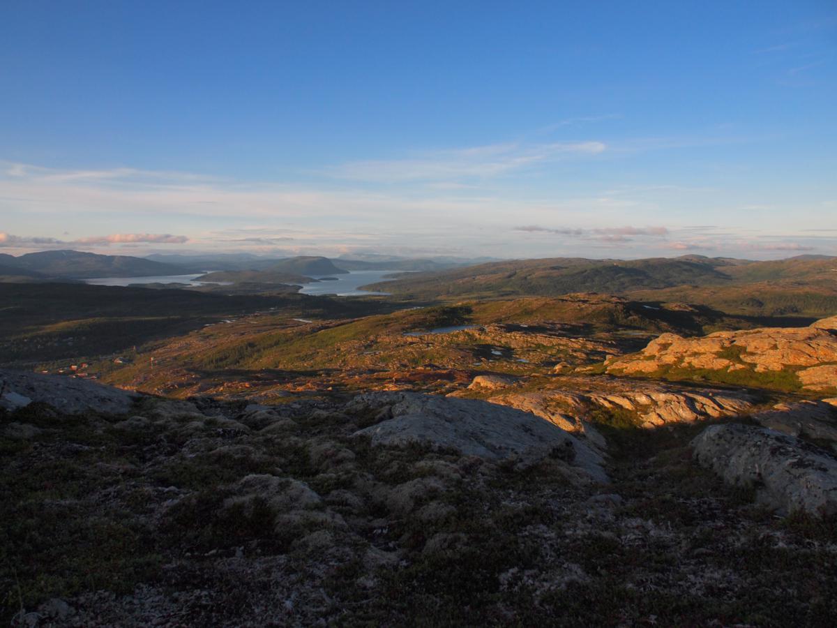
The Granheim farm also is the trailhead of a DNT-trail following the eastern slopes of the Speltfjelldalen valley towards the Gressavasshytta cabin. The path starts to climb through birch forest towards the west ridge of the Artfjellet. I cross a group of 6 women on the way up, who complain about the grey weather they have had during their trip from Umbukta. Looks like they have made their trip 3 days too early! When I reach the ridge, a phenomenal view onto the valley, with the river meandering peacefully through enormous peat bogs, opens up. The clouds have lifted and the highest peaks of the Okstindan range, Okshornet (1901m) and Oksskolten (1916m, highest mountain in Northern Norway) opens up. Small glaciers tumble down their eastern slopes.

Waterfall on the lower Speelhtejohke river

Waterfall on the lower Speelhtejohke river

First views onto the Okstinden range while climbing onto the Artfjellet ridge

First views onto the Okstinden range while climbing onto the Artfjellet ridge

Snow grouse on the slopes of Artfjellet

Snow grouse on the slopes of Artfjellet

While the light gets softer I continue traversing the slopes of Artfjellet in this astounding scenery. Just before crossing the Artfjellbekken stream I find a nice, flat spot on the slope close to a big boulder. I immediately decide to stop and pitch my tarp. It is one of the finest camps of the entire trip and I stay outside long after sunset to enjoy the views, and the arrival of summers last recrudescence.

The magnificent Speltfjelldalen valley, with Oksskolten in the back, as seen while traversing the slopes of Artfjellet

The magnificent Speltfjelldalen valley, with Oksskolten in the back, as seen while traversing the slopes of Artfjellet

Splendid bivouac high above the Speltfjelldalen

Splendid bivouac high above the Speltfjelldalen

Splendid bivouac high above the Speltfjelldalen

Splendid bivouac high above the Speltfjelldalen

Splendid bivouac high above the Speltfjelldalen

Splendid bivouac high above the Speltfjelldalen

The valley is filled with fog the next morning, but I am high above the humid zone and pack in warm sunshine. I am now one day ahead of schedule and I know all too well what I want to day with that day: go for a bivouac on the very summit of Oksskolten (1916m), the highest mountain of the range and of entire northern Norway. I can’t keep my eyes of the summit, which still towers an impressive 1300m above me, while continuing north on the panoramic route above the splendid Speltfjelldalen.

Morning above the Speltfjelldalen

Morning above the Speltfjelldalen

The lower Speltfjelldalen as seen while continuing the traverse above the valley

The lower Speltfjelldalen as seen while continuing the traverse above the valley

A few kilometers before reaching the Gressavasshytta I leave the trail and start my off-trail approach of the mountain. I have no idea if there is any route up marked by cairns or whatever, but looking at the maps the best route seems to be up the NW-ridge, starting from the proglacial Bretjønna lake at the snout of the huge Austre Okstindbreen, a glacier with an area of about 13km². I skirt along the Okstindtjønna lake and continue west until I finally reach the base of the mountain. Vegetation clearly becomes more scarce when I approach the snout of the rapidly retreating glacier.

The proglacial Bretjønna lake at the base of the Oksskolten climb

The proglacial Bretjønna lake at the base of the Oksskolten climb

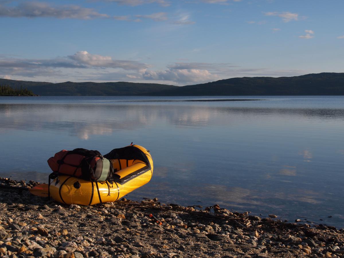
It is 1 o’clock when I reach the Bretjønna lake. 1200m of ascent still separate me from the summit. I take a very long break not to be up there too early. Like always before I attempt a summit bivouac, I am overwhelmed by a mix of feelings of joy and nervosity. I hide my raft and paddle between some boulders to lighten my pack and then start climbing at around 3 o’clock.

I first climb up boulders along a stream draining the Oksskoltbreen, a small glacier in a cirque higher up the northern slopes of the mountain. At around 950m I reach the base of a long section of steep rock slabs, which are often wet and slippery because of melting snowfields higher up the slopes. With great care and a detour every now and then I make slow progress until the gradient eases at around 1150m. I quickly build a cairn to find back my route tomorrow morning. After that, I easily climb further up until I reach a bowl at 1200m, where I take a break to eat and drink before continuing. The final section of the NW-ridge looks rather impressive from this perspective. While I am sitting there, I suddenly notice a couple descending. We have a quick chat. They are Swiss making a 3 week tour in Northern Norway, and call the summit better than anything they have done in the Alps. Then they start complaining about the weather during the first half of august. Well, lucky they had not planned their trip in july…

Looking back at the snout of Austre Okstindbreen

Looking back at the snout of Austre Okstindbreen

Climbing along the Austra Okstindbreen

Climbing along the Austra Okstindbreen

I continue climbing on easy snowfields until I reach the NW-ridge near a pass at about 1350m, and then start tracking the ridge, which gets steeper and steeper, towards the summit. The views onto the Austre Okstindbreen are phenomenal. At about 1550m the most difficult part of the climb starts, with regular scrambles on boulders and rocks. At one point I say to myself: “well, if it gets any harder than this I better turn back”. But it doesn’t get any harder and at 1780m the ridge suddenly flattens out, a point which is marked by a huge cairn (the only one of the entire climb). The remainder of the climb is an easy hike while I start absorbing the landscape. At 6 o’clock I reach the summit of Oksskolten.

View back from the base of the steep part of the NW-ridge

View back from the base of the steep part of the NW-ridge

The views are extraordinary and amongst the best I’ve had in my life. Immense glaciers, notably the Austre Okstindbreen, drape the entire wild hearth of the range, with summits like Tvillingtindan and Okstinden (1804m) looking like small nunataks from my perspective. The Svartisen glacier is clearly visible in the west, Saltfjellet and even Sulitjelma dominate the northern horizon, with the Gresvatnet lake deep below me in front. The huge Rossvatnet, with Børgefjell in the back, is visible in the south. And then there is of course hundreds of lakes and mountains everywhere around me I cannot name.

Fog drifts around the summit while the sun sets, making for a mysterious and dramatic atmosphere. I find a place to sleep about 10 meters below the summit; and when I open my eyes during the night, I can see stars for the first time of the trip. Autumn is on its way south and I won’t be long before the northern lights will start the cast their ghostly shadows upon the sleeping land.

Okshornet as seen from the summit of Oksskolten

Okshornet as seen from the summit of Oksskolten

Charles-Rabotbreen, with Gresvatnet in the back

Charles-Rabotbreen, with Gresvatnet in the back

The Austra Okstindbreen, with the summits of Tvillingtanden and Okstinden at the other side of the glacier

The Austra Okstindbreen, with the summits of Tvillingtanden and Okstinden at the other side of the glacier

The huge Gresvatnet as seen from the summit of Oksskolten

The huge Gresvatnet as seen from the summit of Oksskolten

Evening light on the summit of Okshornet

Evening light on the summit of Okshornet

Sunset from Oksskolten, with the snout of Austre Okstindbreen deep below

Sunset from Oksskolten, with the snout of Austre Okstindbreen deep below

Bivouac spot on the summit of Oksskolten

Bivouac spot on the summit of Oksskolten

I wake up at 5 o’clock in the morning. The sun is already up and I have breakfast at the summit while admiring the views for one last time. It’s always wonderful to see how the landscape shows new subtleties with the sunlight coming from the other side. At 6.30 I leave the summit of Osskolten. I carefully navigate down the ridge again, take a break in the bowl and then find back my route across the rock slabs and down to the lake, which I reach a bit after 9 o’clock.

The upper part of Austra Okstindbreen with Rossvatnet in the back, as seen from Oksskolten in the morning

The upper part of Austra Okstindbreen with Rossvatnet in the back, as seen from Oksskolten in the morning

Ready to leave the summit of Oksskolten

Ready to leave the summit of Oksskolten

My plan for the day is easy: I will descend to the Gresvatnet lake, inflate my raft and paddle across both the Gresvatnet and Over-Uman lakes towards Umbukta, where I have a food drop waiting. It should be a 5-6 hour stage from this point, and I am ready to make a good pace so I can arrive early, take a shower and enjoy a beer on the terrace. I descend off-trail along the thundering glacial Oksfjellelva river until I reach the shores of the lake.

But I have a problem. A northerly wind (headwind) has suddenly picked up, with relatively large waves sweeping across the lake. No way I can make it across in these conditions. For every lake I have prepared a ‘plan B’ at home, with some maps to allow an on-shore detour. But apparently I have forgotten to print the maps for the Gresvatnet – Over-Uman stretch. I know there is a DNT-path from Gressvasshytta towards Umbukta, but I have no idea how long it is (I vaguely remember 5 DNT-hours), and have no map are whatever I case the trail is poorly marked. But my options are few and I only have food left for today, so I start walking anyway with the intention to make it all the way to Umbukta.

Descending back to the Bretjønna lake

Descending back to the Bretjønna lake

Downstream along the Oksfjellelva, with the Oksskolten summit in the back

Downstream along the Oksfjellelva, with the Oksskolten summit in the back

I follow the southern shore of Gresvatnet of sometimes rough terrain until I reach the dam at the western end of the lake. Waymarking has been good so far, but here the DNT-volunteer seems to have been running out of paint. Nothing to be found anywhere. No mobile phone coverage to have a quick check on the general route description on the DNT-website. There is a valley towards the north and I have a bet that’s the one I have to walk through. I cross the dam and after 2km of off-trail hiking, I find a marking again! Ouf! I take a break, then continue following the valley (Storskardet), which offers highly enjoyable tundra terrain and splendid views back towards the Oksskolten summit. My hopes to make it to Umbukta are high again.

View back towards Oksskolten while hiking north through Storskardet

View back towards Oksskolten while hiking north through Storskardet

By 2 o’clock in the afternoon I reach the northern end of the valley. A massive view onto the Storakersvatnet opens up. But this is also the point where I realize I’m not quite there yet. I have been in Umbukta during a winter trek in april and recognize some points in the landscape. The only conclusion I can draw from this is that it is at least another 15km towards the hut. It is the warmest day of the entire summer with temperatures well into the 20’s. The wind has dropped and the sun doesn’t take a break for the entire day. I literaly get cooked when I traverse above the lake, and feel my energy level running lower and lower as I have to descend into and climb out of yet another deep gully cutting through the slopes.

I am near Grunnvasskardet, only 6km short of Umbukta (and back onto my maps), when realize I am getting dehydrated and sunstroked. It is 5 o’clock. Instead of pushing on immediately, I decide to take a long break, cook dinner and drink 2 liters of water. In the meantime the temperature starts to drop. After one hour I get going again, cross a final pass, batter through a long peat bog and eventually reach the Umbukta hut a bit before eight in the evening. I have been on the trail for well over 13 hours, covered 35km and made an accumulated altitude difference of nearly 3000m. It has been the longest hiking day I have ever made and I feel absolutely knackered when I ring the doorbell at the hut. It is a very sobering feeling that guys like Skurka can make this kind of stages for months and months.

Traversing above the Storarkersvatnet on a hot august afternoon

Traversing above the Storarkersvatnet on a hot august afternoon

View back on the huge Storakersvatnet

View back on the huge Storakersvatnet

Last meters towards Umbukta

Last meters towards Umbukta

Thor-Inge is not a standard warden. He is one of the very few people who have covered Norge pa Langs both in summer ánd in winter. I guess I must have looked rather spent when he opens the door.
He immediately askes: “where have you walked from???”.
“Today?”, I answer.
“No, no, before…”
“Lindesnes”
“Come with me”, he says. He gets the key of the Stabburet, a small authentic side building. I get it for free for the night! I also get my beer for free. I feel intensely happy when I feel my muscles relax on the terrace in the warm evening sun. Sometimes life is even better than you could have dreamt it.

Stages:
11/08/2012: Hattfjelldal – Tolkmoen (33km, +290/-130, 6h30)
12/08/2012: Tolkmoen – Speltfjelldalen (25km, +400/-40, 6h30)
13/08/2012: Speltfjelldalen – Oksskolten (20km, +1480/-410, 6h45)
14/08/2012: Oksskolten – Umbukta (35km, +660/-2050, 9h10)

Map Hattfjelldal - Umbukta

Map Hattfjelldal – Umbukta

Day 64-70: A perfect week hiking and packrafting Børgefjell

If you were to ask me now what the very best part of my trip was, I wouldn’t hesitate too long. It’s hard to describe the flow I’m in after over two months on the trail, a flow where everything except the most primary things feel absolutely trivial. The only things that really matter are eating, sleeping and walking. It’s a flow where you never look ahead more than one day. Then there is also the physical aspect: my shape is better than it ever has been, and I have the feeling I can just do what I want without ever getting tired. The combination of both makes for a dangerous but addictive feeling of youthful invulnerability. It makes me feel one with my environment; the mountains, the grazing reindeer and shifting weather. It gives me a pure and overwhelming feeling of happiness. It makes me feel complete. Despite all the astounding moments I’ve experienced in the mountains, this is a feeling of another level which doesn’t occur to me too often. The last time was during an evening climb on the Pic Sacroux in the Pyrenees in 2010. And now it happened again, in the Børgefjell National Park, the gateway to the mountains of Northern Norway.

Evening on the Pic Sacroux in the Central Pyrenees, summer 2010

Evening on the Pic Sacroux in the Central Pyrenees, summer 2010

But first I have to make it to Børgefjell! And that soon proves to be a challenging undertaking. After the splendid evening, the weather has changed during the night along the Luru river. It is now overcast with some drizzle every now and then. Swarms of mosquitos buzz around my head. The day starts with a serious off-trail sections through pine forest and deep swamps. I ford the Medalaa river and then find connection to a series of old tractor tracks, which guide me northeast for a few kilometers up the southern slopes of Gusliklumpen.

Swamps on the way to Medaala river

Swamps on the way to Medaala river

The main course for today is waiting. I have to cross the Gusliklumpen plateau and descend into the Sanddalen valley, a long off-trail section. I don’t have a good day and experience the next few hours, through horrible terrain, as some of the hardest of the entire trip. First I struggle up the hill through thick forest en brush, with difficult navigation. Once I’m finally above the treeline I notice I am too far west on the hill. I traverse back to my intended route, and then fight my way further up through brush and peat. It feels like I am not making any progress. I’ve walked for over three hours when I finally reach the summit of Oystre Gusliklumpen (631m).

Climbing onto the Gusliklumpen plateau

Climbing onto the Gusliklumpen plateau

The Sanddalen valley as seen from the Gusliklumpen plateau, nasty bushwhacking ahead

The Sanddalen valley as seen from the Gusliklumpen plateau, nasty bushwhacking ahead

The terrain doesn’t get any better on the descent into the Sanddalen, but now at least the topography is helping me a bit and I make it down easily. I find connection to a gravel road, which I follow upstream for a few kilometers until I reach a bridge across the river. On the other side I leave the road again and climb up the steep flank of the valley on another gravel road, which I follow for nearly two boring hours through the forest. I finally reach the old farm buildings of Berg, the trailhead of the DNT-trail towards Skorovatn. Two pickups, probably of fishermen, are parked on the small parking lot. I feel my body is nearly done for today. I continue climbing through the pine forest for about half an hour until I reach a plateau (440m) near the confluence of a few streams, south of the Bergfjellet (571m) hill. It a mosquito paradise, but I don’t have the energy left to climb above the treeline.

Bivouac on the plateau south of Bergfjellet

Bivouac on the plateau south of Bergfjellet

The DNT-trail towards Skorovatn is a typical one for Central Norway: it is cross-country walking between some occasional markings rather than hiking a real trail. I climb above the treeline near the Tjønnrølet lake and the terrain gradually becomes easier after that as I climb further up the Skardfjellet and the vegetation becomes more scarce. After some rolling terrain east of the Skardfjellvatnet I get the large Reinsjøen lake within view around noon. As the lake’s name predicted I spot a solitary male bull with a huge antler near the southern shore.

View onto the Skardfjellvatnet lake

View onto the Skardfjellvatnet lake

Male reindeer near the Reinsjøen lake

Male reindeer near the Reinsjøen lake

My mood makes a dip when it starts to rain, rain which persists for most of the afternoon. The terrain also becomes less enjoyable while I descend towards the Midtre Nesavatnet and the tundra makes way for long bushwhacking sections. I take a short break at a cabin near the lake, then continue up towards the Kroktjønna, where I reach the junction with another trail. I opt for the shortest way towards Skorovatn. After a steep, short climb away from the lake I reach the tundra level again and progress towards the Gruvfjellet becomes easy. After crossing the plateau I stop near a group of lakes just before starting the final descent into the town. It’s a bit after five o’clock in the afternoon when I arrive and the weather starts to clear. The view from my bivouac spot makes me a bit emotional: the vast Tunnsjøen lake, the first of a series of large lakes, lays at my feet bathing in the evening sun. It will mark the start of a new episode in my trip: the episode in which I will combine hiking with packrafting.

Midtre Nesavatnet, in the rain...

Midtre Nesavatnet, in the rain…

Bivouac on the Gruvfjellet above Skorovatn

Bivouac on the Gruvfjellet above Skorovatn

Evening sun on the vast Tunnsjøen lake as seen from Gruvfjellet

Evening sun on the vast Tunnsjøen lake as seen from Gruvfjellet

The conditions are just perfect the following morning: clear skies and a tiny bit of wind from the west. I wake up early and start hiking a bit after seven in the morning. My plan is to make maximum use of the conditions and have a really big day. I descend to the still sleeping town of Skorovatn and start following the asphalt road towards the Tunnsjøen lake. As I want to cross both the Tunnsjøen and the Limingen lakes today by packraft, I decide to continue walking along the quiet road for a few more kilometers and put in near the Tunnsjøenelv bridge instead of near the Stallvika farms (which I initially planned). That makes my flatwater packrafting distance for today 22km instead of 27km, which could have been a bit too much for a first day.

Tunnsjøen lake near Skorovatn

Tunnsjøen lake near Skorovatn

I inflate my raft on the Jakopsundet lake, a western branch of the Tunnsjøen. It is a brilliant, sunny day and I paddle in t-shirt. When I near the Tunnsjøenelv bridge, I feel my progress becomes very slow and I have to fight to make it to the bridge. Below me, cristal clear water races by in a channel at least 5m deep! I have not studies my maps thouroughly, and have just tried to paddle against the outflow of the entire Tunnsjøen lake! I feel ridiculous when I take out and start walking along the road again with my packraft strapped to my shoulder. Continuing on the outflow like this, it would clearly take some time to cover the last few hundred meters towards the lake!

I walk for a kilometer until I reach the Tunnsjøen near a group of vacation cabins. And that is the real start of the packrafting: a 15km flatwater section along the northwestern shore of the lake. In intensely enjoy my sunny day on the water and enjoy the surroundings from a new perspective. Pine forests, gravel beaches, a horizon with snow-capped mountains and the small, bowler hat like island of Gudfjelløya in the middle of the lake, its summit rising nearly 500m above the water level, are my scenery for the day. Every now and then I pass a farm building, where cows curiously stare at that tiny yellow boat passing by. One bull chases me on the shore.

Paddling across the Tunnsjøen lake

Paddling across the Tunnsjøen lake

A break along the Tunnsjøen lake

A break along the Tunnsjøen lake

Around 4 o’clock I reach the northern tip of the lake. I pack my raft, take a break to eat and drink, then continue walking on the asphalt road towards the Limingen lake. It’s a 9km section, but I don’t care too much. Hardly any car passes by on the entire stretch and the views on the nearby mountains, their summits rising up to a bit over 1000m, are pretty enough not to get bored. I inflate my raft again when I reach the western tip of the lake near Gjersvika. It is already well past six in the evening when I start a 7km evening raft across the Limingen lake.

The quiet asphalt road towards Limingen

The quiet asphalt road towards Limingen

I becomes one of the finest evenings of the entire trip. The wind drops entirely and the lake, measuring 25km along its axis, becomes flat like a mirror. Every stroke brings me closer to delirium. Knowing this moment is unique, I take my time for the crossing, and remember I’m almost disappointed when I finally reach the Sagvika farm, just 2km short of Røyrvik, in the evening hours. It is still warm in the sun and I have a wash in the lake to finish the day. I’ve been on the road for well over 12 hours and covered a dazzling 41km. The coolest of this all is that I’ve almost done a double stage today… which will allow me to have some extra time in the mountains!

A perfect evening crossing of Limingen Lake

A perfect evening crossing of Limingen Lake

Putting out of Limingen

Putting out of Limingen

It gets cool (+2°C) during the night, but when I wake up the sun is already high in a perfectly clear sky. I cover the last kilometers to Røyrvik, where I am happy to find a Joker supermarket (which saves me a frustrating hitchhiking day). I buy supplies for the 4-day stretch through Børgefjell, plus an entire bag of fruit and yoghurt which I all eat in front of the shop before continuing. I subsequently walk 2km of asphalt road until I reach the bridge across Hovden, the southern outlet of the Vektaren lake. I inflate my packraft and cross the lake from south to north (5km). After taking out I continue walking for another one hour and a half along another quiet asphalt road until I reach the harbor of the Namsvatnet lake.

From this little harbor, there is a regular boat service across the lake towards the Børgefjell National Park. But I spot something else: a little building in the harbor is open to visitors… and after a short inspections, I am happy to find a shower inside. I don’t hesitate to have a good wash (first shower in 10 days), and also use the electricity sockets to recharge my camera batteries and phone for an hour. It’s already nearing 4 o’clock when I finally start crossing the lake by packraft.

Some slight showers are active around the lake and a headwind from the northwest, causing small breaking waves, has picked up while I cross. I paddle as hard as I can to win the fight, and beach my raft near a cabin about 100m east of the lake’s dam. A couple is renovating the entire building. They invite me in for a cup of tea and some cake. The man knows the area very well and we go through my plans together. He discourages me to try rafting the Namsen river downstream of the dam because of very low water levels. We work out an alternative route along the Karivatnan and Sjurtjønnin lakes to climb into Børgefjell.

Putting out of the Namsvatnet lake

Putting out of the Namsvatnet lake

I follow the river downstream along a jeep track up to Kanflyen, and then climb up a very faint trace through thick brush until I reach the Karivatnan lakes. The stream connecting both lakes makes for a good wade. The terrain gradually eases when I climb further up through birch forest towards the Sjurtjønnin lakes. It is already half past seven in the evening and the retrospective views in the soft evening sunlight are stunning. I continue climbing up until I reach the western tip of a small lake (699m) above the treeline, where I pick a bivouac spot at the western tip of the lake. Two fishermen from Trondheim pass by in the evening and tell me about the bad fishing conditions this year. Because of the cold weather in july the water is colder than normal, which apparently is very bad for the appetite of the fish. The evening brings some dramatic skies. I’m in a good mood. Tomorrow, I’ll be in the real mountains again. Unless most hikers staying in the less mountaineous eastern part of Børgefjell, I’ll try a 3-day off-trail crossing of the seldom visited western mountain ranges, which should offer the most dramatic scenery of the entire National Park.

Climbing into Børgefjell via the Sjurtjønnin lakes

Climbing into Børgefjell via the Sjurtjønnin lakes

Evening view back towards the Sjurtjønnin lakes and Namsvatnet

Evening view back towards the Sjurtjønnin lakes and Namsvatnet

Dramatic evening skies from the bivouac at lake 699m, my Cricket can be seen near the tip of the lake

Dramatic evening skies from the bivouac at lake 699m, my Cricket can be seen near the tip of the lake

After all these fine days I wake up with rain again the following morning. I make the best of it by sleeping long and reading a bit in my book. By noon it gets dry and I decide to leave. After a short climb I reach the Gyojnedhsealma pass. A traverse on slippery rock slabs high above the Bleikarvatnet follows, and after crossing a second pass I descend towards the large Jengelskardvatnet lake. There is a good breeze from the northwest, but I decide to inflate my packraft anyway and fighting agains the crosswinds I make it to the other side of the lake. I portage the outflow for a few hundred meters and then continue rafting the length of the Langvatnet lake. By the time I reach the northern tip of this lake the weather has suddenly started to clear.

Descending towards the Jengelskardvatnet

Descending towards the Jengelskardvatnet

Ready to raft across the Jengeskardvatnet lake!

Ready to raft across the Jengeskardvatnet lake!

I pack my raft again and start climbing in a northeastward direction along the Kyllingen lakes and towards the pass north of Store Kjukkelfjellet (1030m). From this pass, a massive view east on the immense Tjohkelenjabke plateau, infested by swamps, small lakes and probably mosquitos, opens up. The views keep improving as I cross towards the Vajavatnet lake via a little-known ledge. The mountain scenery is now dense and wild, with the Vajavatnet to a large extent still covered with ice and with small glaciers draping the eastern slopes of Gaksfjellet. I have to wade across the outflow of the lake, and then steeply climb on rocky terrain in a N-NNE-direction to the pass separating points 1225m and 1219m.

View back towards Langvatnet and Jengelskardvatnet in clearing weather

View back towards Langvatnet and Jengelskardvatnet in clearing weather

The Tjohkelenjabke plateau as seen from the ledge

The Tjohkelenjabke plateau as seen from the ledge

View back towards Vajavatnet while climbing up to the pass

View back towards Vajavatnet while climbing up to the pass

I leave my bag on the pass and climb up the latter summit, which dominates the Tjohkelenjabke plateau and all its water. But even more impressive, and presumably even one of the finest views I’ve ever seen in Scandinavia, is the view north through the Bissiedurrie valley. The large Nordre and Søre Bisseggvatnet lakes, connected by a river serpenting its way through the valley, rest deep in an impressive mountain scenery of glacier remnant, scattered snowfields and rugged mountains, the highest summits enveloped by clouds. It’s the view which I still automatically associate with the name Børgefjell. The mountain scenery in this little known National Park is much more wild than I had imagined.

View back onto the Tjohkelenjabke plateau, with the ledge towards Vajavatnet to the right

View back onto the Tjohkelenjabke plateau, with the ledge towards Vajavatnet to the right

The wild scenery around the Bissiedurrie valley as seen from summit 1216m

The wild scenery around the Bissiedurrie valley as seen from summit 1216m

I stay on the top for quite a while before descending back to the pass, picking up my pack and then sliding down a series of steep snowfields towards the Søre Bisseggvatnet lake. A large herd of wild reindeer races by on the way. I walk towards the northern tip of the lake, wade the powerful inflow and find a place to camp right at the other side. Because of my late start it is already near 8 o’clock in the evening when I get there. I cook, continue reading a bit and go to sleep.

Descending towards the Søre Bisseggvatnet in Central Børgefjell

Descending towards the Søre Bisseggvatnet in Central Børgefjell

Bivouac along the inflow of Søre Bisseggvatnet

Bivouac along the inflow of Søre Bisseggvatnet

I have put my alarm clock early the following morning, but when I wake up at 6 o’clock it is calm weather with a very low cloudbase, so I continue sleeping a bit. By 8 o’clock the weather has changed dramatically: the clouds break and makes way for a perfectly clear sky. I start packing as fast as I can: I have a dream today and that dream is to climb Kvigtinden (1699m), the highest mountain in Børgefjell. Its summit is less than three hours of walking away!

Not a single cloud remains when I start hiking. It looks like it’s going to be an extraordinarily fine day. I climb up towards the Kvigvatnet lake (1090m) through increasingly rough and rocky terrain. I then have to traverse the slopes above the frozen lake to be able to climb towards the pass (1250m) northwest of the Kvigtinden summit. But most of this traverse above is still covered by an extensive snowfields, which is icy and hard like bone because of the overnight frost. The slope is about 25-30°. At a certain point I cannot progress any further because I would just slide down into the lake. I don’t have crampons nor an ice axe, but I work out a different solution: by scratching tiny stands in the icy with the metal tip of my trekking poles, I am able to provide myself with the necessary grip for my feet. It takes a while, but after some time the steepest section is behind me and I can continue in a more comfortable way.

Climbing up towards the Kvigvatnet

Climbing up towards the Kvigvatnet

View back onto the steepest part of the traverse on icy snow above the frozen Kvigvatnet

View back onto the steepest part of the traverse on icy snow above the frozen Kvigvatnet

I soon reach the pass an descend on the other side on endless snowfields. It’s amazing how much snow remains still in the mountains in august. When I reach a cluster of frozen lakes (1180m) I decide to leave my pack and try go summiting Kvigtinden (1699m). I take a very short break to eat something and then start racing up as fast as I can. Some grey stratocumulus clouds are already appearing and I really want my first big mountain of the trip (ánd my views from the summit!).

Climbing the north ridge of Kvigtinden (1699m)

Climbing the north ridge of Kvigtinden (1699m)

I easily gain the northeast ridge at an altitude of 1350m, and start tracking the ridge towards the summit. Two rock bands at 1400-1450m call for some easy scrambling, but I close in fairly easily. It’s a race against time though with clouds already hugging the summit every now and then. The final 20m are a bit less clear again with some easy scrambles. By 11.40am I have reached the highest mountain of Børgefjell and the first major peak of Northern Norway. I am ecstatic. Huge crevassed glaciers tumble down the eastern slopes of the mountains, with horrifying bergschrund where they meet the bedrock at the upper side. At their lower end the mountains make way for the endless rolling hills and wastelands of eastern Børgefjell. Through the thickening clouds I only get scattered views of the mountain scenery in the north and the west, but what I see of it is wild and deserted. Yep, Børgefjell surely is one of these areas I really want to visit again in the future.

The summit cairn of Kvigtinden (1699m), Børgefjell's highest mountain

The summit cairn of Kvigtinden (1699m), Børgefjell’s highest mountain

A happy man on the summit of Kvigtinden

A happy man on the summit of Kvigtinden

The glaciers on the eastern flanks of Kvigtinden as seen from the summit towards the south ridge

The glaciers on the eastern flanks of Kvigtinden as seen from the summit towards the south ridge

After some time on the summit I descend back to my backpack and take a long lunch break after the intense morning. Good I did the race: it has become overcast with a cloudbase below the highest summits. A steep descend on snowfields and rock slabs guides me down towards the Austre Masskardsvatnet lakes, which I round along the northern side. I continue east, wade the outflow of the Simskardvatnet lake, and then start traversing the vast tundra plateau east of Simskardvatnet at an altitude of about 900m. The walking is as perfect as it can be: easy, rolling off-trail tundra terrain, top-class mountain scenery in the west and dramatic skies with showers ravaging the main Børgefjell ridge, but quickly dying away when descending the eastern slopes. I continue my dry walk in the rain shadow while admiring the raw interaction between all the elements of a true wilderness. Wow.

Steep descend towards the Austre Masskardvatnet

Steep descend towards the Austre Masskardvatnet

Searching for a place to wade the Simskardelva river, the rolling terrain of eastern Børgefjell in the back

Searching for a place to wade the Simskardelva river, the rolling terrain of eastern Børgefjell in the back

Break along one of the many streams on the tundra plateau east of Simskardfjellet

Break along one of the many streams on the tundra plateau east of Simskardfjellet

The upper Mjølkelva valley and the eastern slopes of the Golvertinden range

The upper Mjølkelva valley and the eastern slopes of the Golvertinden range

The view gets even better when I climb the tiny Giedtietjahketje (958m) summit, with a panoramic view on the entire northern half of the Børgefjell range, the glaciers sliding down the eastern slopes of Golvertinden and giving birth to wild, milky rivers like the Mjølkelva, which thunder down through tundra and birch forest, set to flames by the afternoon sun peeping from in between the towering cumulonimbus clouds. I exclaim my wonder, my marvel, my bewilderment aloud for hours and hours to every reindeer or snow bunting wanting to hear it.

After descending towards a small lake (717m) on the plateau northeast of the Giedtietjahketje (958m) hill, the evening is of an extraordinary beauty and just finishes the job: a perfect walk on a perfect day.

The Mjølkelva river searching its way down towards Susendalen

The Mjølkelva river searching its way down towards Susendalen

Beautiful evening along the shores of lake 717m

Beautiful evening along the shores of lake 717m

Beautiful evening along the shores of lake 717m

Beautiful evening along the shores of lake 717m

Beautiful evening along the shores of lake 717m

Beautiful evening along the shores of lake 717m

I descend into the Susendalen valley on a very wet old jeep track the following morning. To finish the Børgefjell adventure, I still have something exciting on the menu: packrafting the Susna river. I put in near the Sormo farm and immediately pass from the one rapid towards the next, all of them fairly easy PR2-3 water. Although there are roads and scattered farms on both sides of the river, I don’t experience this proximity of civilization as troublesome. The roads can seldom be seen from the water and there is virtually no traffic. On the other hand, I enjoy some very nice views on the summits of northern Børgefjell from my raft. The river continues meandering through forest and grassland with gravel bars in most bends. After a bit more than an hour I reach the Ivarrud bridge. As the river gets a lot wilder further downstream with PR5 water in a series of ravines, I take out and start portaging along a quiet gravel road on the left bank.

Putting in into the Susna River

Putting in into the Susna River

I continue walking on this road for 11km until I reach the confluence of the Susna river and the Unkerelva river. The river becomes calmer again from this point and I put in again. The character is completely different and much wilder than on the first stretch, however, with the river running through densely forested ravines, with almost no sign of roads or farms. Because of the bedrock running into the river, with narrows at some points, the rapids also have a different character. As I don’t want wet clothing, I portage the wildest one, a PR3-4 just upstream of the Nerli farm, where the river gets squeezed through a 5-10m narrow with a serious and very fast wave train. I get some water into my raft in a rapid a bit upstream of the Kolmila bridge. The rafting is great fun though and way too fast I reach the outskirts of Hattfjelldal, where I have to take out.

Portaging the rapid upstream of Njerli

Portaging the rapid upstream of Njerli

I pitch my tent on a small, cozy camping at the southern side of the village and go to the supermarket to go shopping for the next stretch towards Umbukta. I also send some maps back home. And of course I have a hamburger at the local service station. I rains slightly during the evening. I get my laundry done with a real washing machine, take a shower, and then just chill inside of the camping building with a can of coke and a bag of chips while watching athletics at the Olympics in London. Oh boy, what an incredibly intense week it had been. And when I watch the weather forecast for the coming week, I immediately know the trip is growing towards its momentum. A long series of brilliant sunny days is predicted. It only takes seconds before a new big plan is born: I want to go sleeping on the summit of Okskolten (1912m), the highest mountain in northern Norway.

Stages:
04/08/2012: Luru River – Nordelva plateau 440m (27km, +870/-620, 7h30)
05/08/2012: Nordelva plateau 440m – Gruvfjellet (24km, +820/-510, 7h05)
06/08/2012: Gruvfjellet – Sagvika (41km, +310/-640, 10h05)
07/08/2012: Sagvika – Sjurtjønnin lake 699m (28km, +380/-100, 6h30)
08/08/2012: Sjurtjønnin lake 699m – Søre Bisseggvatnet (21km, +790/-710, 5h40)
09/08/2012: Søre Bisseggvatnet – Lake 717m (26km, +1260/-1320, 8h20)
10/08/2012: Lake 717m – Hattfjelldal (35km, +120/-610, 6h30)

Map Snasa - Hattfjelldal

Map Snasa – Hattfjelldal